


Civil Defence Updates, Warnings and Information
)
Update as at 10am on Friday 5 June 2026:
The heavy rain weather watch has been updated to 1pm-11pm on Friday 5 June.
Update as at 9pm on Thursday 4 June 2026:
The heavy rain weather watch has been extended to 11pm on Friday 5 June.
Take care.
Heavy rain watch for Friday 5 June
🌧️ Looks like winter weather is setting in.
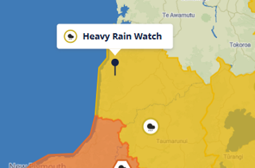
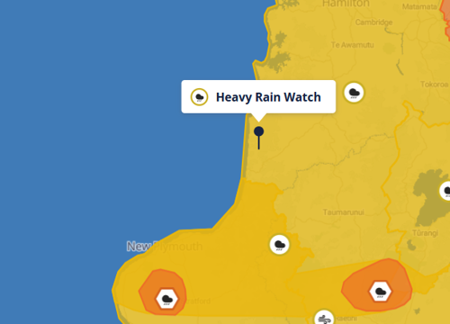
Metservice has issued a heavy rain watch for our district for tomorrow - it is valid from 3am to 9pm Friday 5 June.
Forecast: Periods of heavy rain, and amounts may approach warning criteria. Thunderstorms possible from afternoon. Moderate chance of upgrading to a Warning.
Saturday is not looking good either, particularly for our sports teams.
As always, stay safe and drive to the conditions.
Urgent notice from NZTA - SH3 Awakino Gorge
NZTA have CLOSED SH3 through the Awakino Gorge because significant rainfall has made the route unsafe for travel.
The closure is in place from the rest area near the Awakino Historic Tunnel through to the intersection of SH3 with Manganui Road.
The number one priority is keeping people safe. NZTA have not made this decision lightly, but current conditions mean the road is currently not safe for traffic to use.
Road users are being advised to use SH4 and SH1 as the alternative state highway route and should not travel to the closure area. Please follow all signage, traffic management, and any instructions from onsite staff.
A geotechnical engineer is on site and will review conditions at 1pm. NZTA will provide a further update by 2pm today (2 June). Updates are also available on Journey Planner: journeys.nzta.govt.nz
The gorge remains an active worksite with active slip areas, and conditions can change quickly. A Trigger Action Response Plan (TARP) guides how NZTA responds when conditions become riskier than normal, including rainfall and site checks. We will restore access as soon as it is safe to do so.
We know this will be frustrating and disruptive for communities, local businesses and freight operators.
Thank you for your patience and understanding.
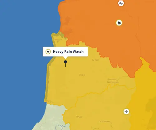
Heavy Rain Watch
Awakino Transfer Station Open Hours
Kerbside collection for Awakino/Mōkau will not be available while SH3 remains closed.
For residents wishing to dispose of their rubbish and recycling, Awakino Transfer Station will be open from 10am Friday 24 April 2026 to 5pm on Monday 27 April 2026 (ANZAC Day Public Holiday)
Please note all other transfer stations in Waitomo District will be closed for the Monday public holiday.
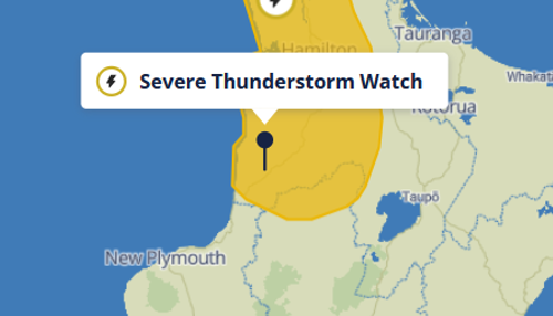
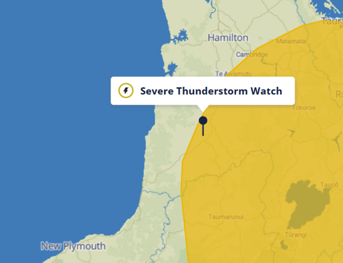
Severe Thunderstorm Watch
An active line of heavy showers and thunderstorms is expected to move across the upper North Island this afternoon and evening. There is a moderate risk that some of these thunderstorms may become SEVERE with rainfall intensities of 25 to 40 mm/h, hail 10 to 20mm in diameter and strong wind gusts about Auckland, Waikato and now extending down in to Waitomo and northern Taumarunui.
Rainfall of this intensity can cause surface and/or flash flooding, especially about low- lying areas such as streams, rivers or narrow valleys, and may also lead to slips. Driving conditions will also be hazardous with surface flooding and poor visibility in heavy rain. Large hail can cause significant damage to crops, orchards, vines, glasshouses and vehicles, as well as make driving conditions hazardous. Wind gusts of this strength can cause some structural damage, including trees and power lines, and may make driving hazardous.
Update from NZTA - 2.30pm
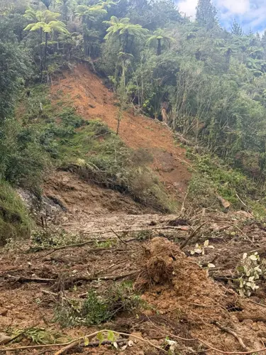
SH3 between Mōkau and Piopio will remain CLOSED overnight and until further notice due to significant damage caused by heavy rainfall this weekend.
There are multiple large slips in the area, and crews are working hard to keep road users safe and clear the road as quickly as possible.
SH43 between Whangamomona and Taumarunui will also remain CLOSED overnight due to flooding.
Update at 12.30pm:
SH43 is closed again due to flooding. SH3 remains closed.
Update 8.55am - Weather warnings lifted, SH3 closed
All weather warnings for our district have been lifted. SH3 between Piopio and Mōkau remains closed. NZTA will provide an update when it is reopened.
SH43 is open.
https://www.journeys.nzta.govt.nz/highway-conditions/waikato
🔴🔴 Severe Thunderstorm Warning
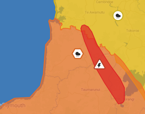
Metservice has issued a Red Severe Thunderstorm Warning for part of our district.
Area: Waitomo, Taupō, Ruapehu and Ōtorohanga
Forecast: At 08:37 pm, Metservice weather radar detected severe thunderstorms near Maniaiti/Benneydale, Waipa Valley and Mangapehi.
These thunderstorms are expected to be accompanied by very heavy rain.
Impact: Very heavy rain can cause surface and/or flash flooding about streams, gullies and urban areas, and make driving conditions extremely hazardous.
Please stay safe and keep informed.
You can phone us on 0800 932 4357 to report any issues.
The National Emergency Management Agency advises that as storms approach you should:
Take shelter, preferably indoors away from windows;
Avoid sheltering under trees, if outside;
Get back to land, if outdoors on the water;
Move cars under cover or away from trees;
Secure any loose objects around your property;
Check that drains and gutters are clear;
Be ready to slow down or stop, if driving.
During and after the storm, you should also:
Beware of fallen trees and power lines;
Avoid streams and drains as you may be swept away in flash flooding.
SH3 closed due to flooding and rockfalls.
Due to flooding and rockfalls, SH3 between Piopio and Mōkau is closed.
There is no immediate detour through the area. Delay travel through the area or consider an alternative route for travel.
The road will remain CLOSED overnight, with an update due tomorrow morning, Sunday 19 April.
Flooding and rockfalls on SH3
There are reports of flooding and rockfalls along SH3 at multiple locations between Mōkau and Piopio. Police and contractors are attending. Expect delays and exercise additional care along this route.
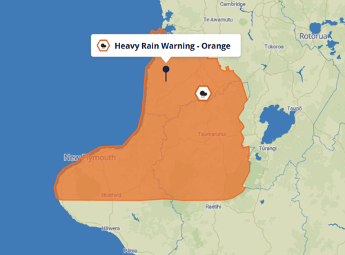
Heavy rain warning
🟠🟠 Stay inside this weekend and play some boardgames - a heavy rain warning has been issued for Waitomo District and Taranaki.
Good suggestions: Catan, Cluedo, Articulate, Ticket to Ride, Monopoly
Not so good suggestions: Risk
The details: The warning is valid for 18 hours from 10am Saturday 18 April to 9am Sunday 19 April.
Expect 80 to 110mm of rain, likely more about Taranaki Maunga. Peaks rates of 15 to 25 mm/h in possible thunderstorms.
The river levels are quite high currently and given the level of ground saturation there could be some impacts from this.
Rain of this intensity has the potential to cause surface or flash flooding. Do not attempt to swim, walk, or drive through flood waters and be sure to drive to conditions.
There is also a moderate risk of thunderstorms and a low risk that small tornadoes could form.
Stay inside. Avoid unnecessary travel. Strong winds can fell trees and poles, tear off roofs, and cause branches and debris to fly at high speed.
Heavy rain watch
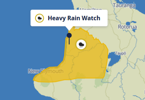
The rain has returned and Metservice has issued a heavy rain watch for our district.
Period: 9am - 8pm Monday 13 April
Area: Northern Taranaki, Waitomo, Taumarunui, and Taupo west of the Lake
Forecast: Periods of heavy rain, with thunderstorms possible. Rainfall amounts may approach warning criteria in localised areas. Moderate chance of upgrading to a Warning.
Stay safe and drive to the conditions.
Cyclone Vaianu passes through, watches and warnings lifted.
Metservice has lifted the heavy rain watch and strong wind warning for our district.
Impacts across the Western Waikato remain minor and localised, with no welfare needs identified. Response activity moves to a monitoring level now that the cyclone system has moved further east off the coast and some distance from our Western Waikato area. Te Whare Āhuru remains in a position to scale up at short notice. The EOC will continue to operate in a scaled-back structure with the ability to respond as needed.
A small number of issues are being managed, including a rural road closure, minor surface flooding, one isolated power outage, and rising river levels which remain below trigger thresholds. These are all under action incurring no significant risk. Monitoring will continue overnight.
The Waikato Civil Defence region-wide State of Emergency remains in place while warnings and watches continue to be monitored.
We've got you covered! Emergency Operations Centre stood up for Western Waikato
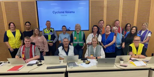
A Western Waikato Emergency Operations Centre (EOC) is operating in Te Awamutu, supporting the Waipā, Waitomo and Ōtorohanga communities during Cyclone Vaianu.
The Centre, Te Whare Ᾱhuru, is coordinating the local Civil Defence response for Ōtorohanga District Council, Waipā District Council and Waitomo District Council, aligned with regional and national Civil Defence efforts.
Controller Dave Simes says the Centre is monitoring the cyclone’s progress across the North Island, with teams on standby to respond and provide support across the Western Waikato as needed.
As at 2.30pm 12 April, the districts have avoided the brunt of the cyclone so far, and support is being provided to the small number of affected locations.
Please avoid unnecessary travel.
The heavy rain has set in and there is lots of surface water on our roads.
Please stay at home and do not venture out if travel is not necessary.
Stay safe:
🔸The combination of damaging winds, heavy rain and coastal inundation makes this a potentially life-threatening event.
🔸More rain falling on ground that’s already saturated, means impacts like fallen trees, landslides, flooding and dangerous river conditions are more likely.
🔸Put safety first. Don’t take any chances.
🔸During a storm, stay inside. Don't walk around outside. Don't drive unless necessary. Strong winds can fell trees and poles, tear off roofs, and cause branches and debris to fly at high speed.
🔸Act quickly if you see rising water. Floods and flash floods can happen quickly. If you see rising water, do not wait for official warnings. Head for higher ground and stay away from floodwater.
🔸Do not try to walk, play, swim, or drive in floodwater.
🔸If a landslide occurs – or you see any signs that the ground is unstable – evacuate immediately. Watch for warning signs like small slips or rockfalls, water flowing out of a slope, trees or fences that start to tilt or doors and window frames that start to stick.
🔸Don’t wait for emergency mobile alerts or other official warnings if you see flood waters rising or suspect that a landslide is about to occur – trust your danger sense and act immediately.
🔸Keep up to date with Metservice watches and warnings and follow the advice of Civil Defence group and emergency services.
A strong wind warning remains in place for our district, and is valid until 3am on Monday 13 April.
A heavy rain watch is also in place, and is valid until 8pm this evening.
Avoid unnecessary travel during heavy rain or strong winds
Check on neighbours, especially those who may be elderly, isolated, or without reliable communications.
Put safety first
Keep up to date with Metservice watches and warnings and follow the advice of your local Civil Defence group and emergency services.
A strong wind warning and heavy rain watch remains in place for our district, as Cyclone Vaianu tracks across the region.
Metservice, NEMA, Civil Defence Emergency Management Groups, NZDF, Police and FENZ have been activated in response to Cyclone Vaianu, with coordinated efforts underway across agencies and CDEM Groups.
If you are yet to feel the impacts of Vaianu, there is still time to prepare:
🔹Prepare for power cuts. Have torches ready and ensure you have access to a battery or solar-powered radio so you can stay up to date with the latest information and alerts.
🔹Check on neighbours, especially those who may be elderly, isolated, or without reliable communications.
🔸Put safety first
🔸Keep up to date with Metservice watches and warnings and follow the advice of your local Civil Defence group and emergency services.
Civil Defence activated in response to Cyclone Vaianu
Waitomo District Council 's Civil Defence team are in activation mode in response to Cyclone Vaianu, which has landed on the North Island today (Sunday 12 April) .
A Waikato regionwide State of Emergency has been declared and an Emergency Operations Centre stood up in Te Awamutu, covering Waitomo, Ōtorohanga and Waipā districts.
Pre-emptive State of Emergency declared for Waikato Region
A pre-emptive Waikato regionwide State of Emergency has been declared today as Cyclone Vaianu approaches.
The move has been taken as a precaution given the potentially significant impacts that may be seen across the region from Cyclone Vaianu.
Declaring a State of Emergency allows the Civil Defence Controller access to emergency powers under the Civil Defence Emergency Management (CDEM) Act 2002.
The most commonly-used emergency powers include evacuating premises and places, entering premises, closing roads and public places, requisitioning property, equipment, material or supplies. Of these, enabling evacuations is often the key reason for an emergency declaration.
We don’t know yet whether emergency powers will need to be used, but this declaration means we can act quickly if required.
For Western Waikato Civil Defence (Ōtorohanga, Waipā and Waitomo districts) we are treating this as a heightened readiness situation. We are closely monitoring conditions across the district, particularly in areas where the ground is already saturated and more vulnerable to slips and flooding.
Please take the current warnings seriously.
Metservice warnings remain in place for our area:
Orange Strong Wind Warning (2am-10pm Sunday)
Yellow Heavy Rain Watch (8am-8pm Sunday)
These mean we are expecting hazardous winds and periods of heavy rain as the cyclone makes landfall and travels south over New Zealand.
What you should do now:
Stay up to date with official weather and emergency updates: www.metservice.com/warnings/home
Secure loose items around your property
Clear drains and gutters where it is safe to do so
Avoid unnecessary travel during heavy rain or strong winds
Check on neighbours, whānau, and those who may need extra support
Please stay alert, stay informed, and look out for each other. We will continue to provide updates as the situation develops.

Preparation underway as Cyclone Vaianu approaches
Waitomo District Council staff, our Civil Defence team and contractors are in preparation mode as Cyclone Vaianu approaches, predicting to hit the east coast of the North Island on Sunday.
While forecast details continue to evolve, experience shows the importance of early preparation and staying alert to changing conditions.
Behind the scenes, Emergency Management staff are monitoring forecasts, working with regional and national partners, and liaising with local contacts who provide valuable on-the-ground information. Council teams and contractors are carrying out pre-event checks and are on standby to respond if required.
Residents are encouraged to stay informed over the coming days, check forecasts regularly, and follow any safety advice issued by authorities.
The Great NZ Muster is going ahead in Te Kūiti tomorrow (Saturday 11 April).
Information and advice from Metservice and Civil Defence indicates that Cyclone Vaianu is likely to land on the east coast of the North Island on Sunday morning.
Its exact track is still uncertain including the impact it may have on our district.
Safety and wellbeing is always at the top of our mind and our local Civil Defence team is working with Waikato Civil Defence, and are ready to respond.
We will continue to monitor the weather forecast and will keep you updated if there are changes to the weather system.
We acknowledge and appreciate your understanding.
Prepare ahead for potential bad weather
With a weather warning in place for Sunday, our teams are out checking roadside drains and catchpits across town.
If you have drains on your property, please take a moment to check they’re not blocked.
Keeping private drains clear helps reduce surface flooding and protects our neighbours and township during heavy rain.
We are keeping a close eye on the weather forecast, and will update you when more information comes to hand.
Strong Wind Warning - Sunday 12 April
Metservice has issued a strong wind warning for our district and the majority of the North Island.
The period is from 10am to 10pm on Sunday 12 April.
A heavy rain watch is also still in place.
We are keeping a close eye on the weather forecast, and will update you about our decision on The Great NZ Muster later today 🐑🐑🐑
At this stage, the heavy weather is potentially not due to arrive until Sunday, well after our event. Safety and wellbeing is always at the top of our mind.
Details of the strong wind warning:
Area: Waikato, Waitomo, Taupo and Taumarunui
Forecast: Severe gale easterlies changing to severe gale westerly late afternoon or evening Sunday, gusting 120km/h in exposed places. Moderate chance of upgrading to a Red Warning.
Impact: Damage to trees, powerlines, and unsecured structures possible. Driving may be difficult, especially for high-sided vehicles and motorcycles.
Action: Prepare your property by securing items that can be picked up by strong winds. Drive cautiously.
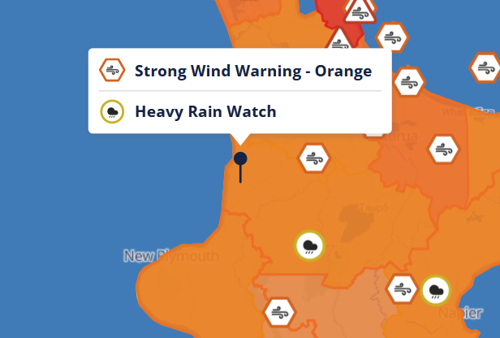
Heavy Rain Watch and Strong Wind Watch
A heavy rain watch and strong wind watch has been issued for our district and the North Island.
Rain watch: From 8am - 8pm Sunday 12 April.
Area: Waitomo, Taumarunui, Taupo and Taranaki
Forecast: Periods of heavy rain, and amounts may approach warning criteria. Moderate chance of upgrading to a Warning.
Wind watch: From 4am Sunday 12 April to 1am Monday 13 April.
Western parts of the North Island, from Coromandel Peninsula to Wellington
Forecast: Easterly quarter winds turning west to southwesterly. Winds are likely to reach severe gale in exposed places and may be damaging. High chance of upgrading to a Warning.
Impact: Damage to trees, powerlines, and unsecured structures possible. Driving may be difficult, especially for high-sided vehicles and motorcycles.
Action: Prepare your property by securing items that can be picked up by strong winds. Drive cautiously.
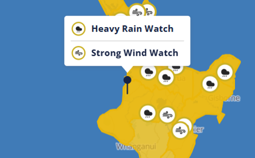
The Great NZ Muster and the weather forecast
Many of you will be wondering if The Great NZ Muster will still be going ahead given there is potential for wet and windy weather this weekend.
Council’s Civil Defence team are keeping a close eye on Cyclone Vaianu, which is predicted to hit parts of the North Island on Sunday.
Its exact track is still uncertain, and while there’s still uncertainty it is hard to make a call at this stage.
We will continue to monitor the weather forecast and will keep you updated as we know more. We will make a call closer to the weekend once we have an update from Metservice and Civil Defence.
We acknowledge and appreciate your understanding.
Strong Wind Watch
A strong wind watch has been added to our heavy rain watch.
The rain watch is valid until 9pm this evening, and the wind watch is forecast from 1am to 11pm on Sunday 12 April.
Forecast: Cyclone Vaianu is likely to move across the North Island on Sunday, 12 April. If it does, it will bring damaging, potentially life-threatening winds. However, uncertainty remains in the cyclone's exact track, so the locations of the most severe winds are not yet certain. As confidence in the track increases, parts of this Watch will be upgraded to Orange or possibly Red Warnings. Vaianu will also bring heavy rain, with Heavy Rain Watches and/or Warnings likely to be issued on Thursday for some areas.
High chance of upgrading to a Warning.
Impact: Damage to trees, powerlines, and unsecured structures possible. Driving may be difficult, especially for high-sided vehicles and motorcycles.
Action: Prepare your property by securing items that can be picked up by strong winds. Drive cautiously.
Heads up - heavy rain watch for Wednesday.
Metservice has issued a heavy rain watch for our district from 3am to 6pm tomorrow (Wednesday 8 April).
Forecast: Periods of heavy rain, with localised downpours possible. Rainfall amounts may approach warning criteria. Thunderstorms possible Wednesday afternoon and evening. Moderate chance of upgrading to a Warning.
Take some time now to get prepared ahead of worst weather setting in.
Key preparedness tips:
🍂 Clear leaves and debris from gutters and drains to help reduce surface flooding
💦 If heavy rain and thunder does arrive, never walk, drive or play in flood water. Flood water can contain dangerous debris, missing manhole covers and the contained water can also make you sick.
Take care while out and about and drive carefully and to the conditions as there may be slips and landslides.
Helpful links to stay up to date:
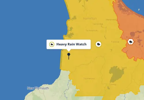
Heavy Rain watch
A heavy rain watch has been issued for our district and is valid from 1am to 8am tomorrow morning (Monday 30 March).
Metservice has indicated the most intense rainfall is expected within the Waitomo area. There is the possibility the Waitomo area could receive up to 50mm of rain accumulation across a 6 hour period between midnight and 6am, while most of the region may see up to 30mm of rain across the same timeframe.
 Clear leaves and debris from gutters and drains to help reduce surface flooding
 If heavy rain and thunder does arrive, never walk, drive or play in flood water. Flood water can contain dangerous debris, missing manhole covers and the contained water can also make you sick.
Warning signs:
Small slips, rock falls, and sinking land, at the bottom of slopes.
Sticking doors and window frames, which may mean the land is slowly moving under the house.
Gaps where window frames are not fitting properly.
Steps, decks, and verandas, moving or tilting away from the rest of the house.
New cracks or bulges on the ground, road, footpath, retaining walls and other hard surfaces.
Tilting trees, retaining walls, or fences.
Water flowing out of a slope, like a new spring.
If you learn or suspect that a landslide is occurring, or is about to occur in your area, here’s what to do:
Move quickly out of its path and stay away from it. Evacuate immediately if it is safe to do so. Your best protection is higher ground outside the path of the landslide.
If you cannot leave safely, the side of your house furthest from the landslide is likely to be the safest location on your property.
Take your pets with you and move livestock to safe paddocks if you can do so without endangering yourself.
Alert your neighbours. They may not be aware of the potential hazard. It may save their lives. Help neighbours who need assistance to evacuate if you can do so without putting yourself in danger.
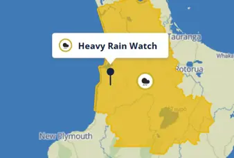
Heavy Rain Watch
Update: 8.45am Friday 27 March. Watch has been cancelled.
A heavy rain watch has been issued for our district.
The watch is valid all of today (Thursday 26 March) until 6pm Friday 27 March.
Metservice details:
Periods of heavy rain. Amounts may exceed warning criteria in localised areas, especially ranges. Moderate chance of upgrading to a Warning.
Take some time now to get prepared in case the weather gets worse.
Stay safe, drive safely and take care while out and about.
Severe Thunderstorm Watch
⛈️🧐 Heads up, a severe thunderstorm watch has been issued for part of our district. The watch is valid from 4.30pm this afternoon to 11pm this evening.
🤞Fingers crossed nothing significant eventuates, but the weather can be very unpredictable.
Here are the details:
A showery unstable air mass is expected to affect the North Island from this afternoon and evening.
There is a moderate risk of severe thunderstorms with localised downpours bringing rainfall intensities of 25 to 40 mm/h. Rainfall of this intensity can cause surface and/or flash flooding, especially about low-lying areas such as streams, rivers or narrow valleys, and may also lead to slips.
Driving conditions will also be hazardous with surface flooding and poor visibility in heavy rain. There may also be slips and landslides.
Take some time now to get prepared ahead of worst weather setting in.
Key preparedness tips:
🍂 Clear leaves and debris from gutters and drains to help reduce surface flooding
💦 If heavy rain and thunder does arrive, never walk, drive or play in flood water. Flood water can contain dangerous debris, missing manhole covers and the contained water can also make you sick.
🏠Stay home for the night. Take advantage of a movie night or boardgame night - Maybe don't play 'Risk' though! 😆
Take care while out and about and drive carefully and to the conditions as there may be slips and landslides.
Helpful channels to stay up to date:
We'll share updates if anything changes.
Please stay safe out there.
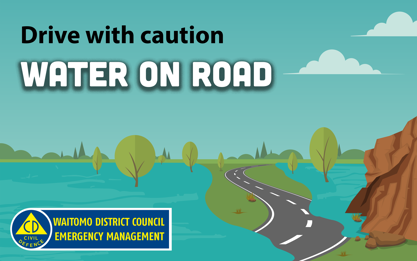
There is a lot of surface water flooding, so please drive carefully and to the conditions. And don't head out if you don't need to.
The heavy rain isn't due to ease until tomorrow morning.
- Stay out of the flood water, and stay away from streams and rivers
- Never walk, drive or play in flood water. Flood water can contain dangerous debris, missing manhole covers and the contained water can also make you sick.
Severe Thunderstorm Warning
Alongside the heat and humidity, we are also expecting a severe thunderstorm 
 Metservice has issued a RED severe thunderstorm warning for parts of our district this evening.
Take some time now to get prepared ahead of worst weather setting in.
Take care while out and about and drive safely and to the conditions.
Update as at 11.30am on Friday 13 February: The watch for our district has been extended to 10am Saturday 14 February.
Heavy rain watch

 Could be a nice way to cool down though?

 Clear leaves and debris from gutters and drains to help reduce surface flooding If heavy rain does arrive, never walk, drive or play in flood water. Flood water can contain dangerous debris, missing manhole covers and the contained water can also make you sick.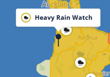
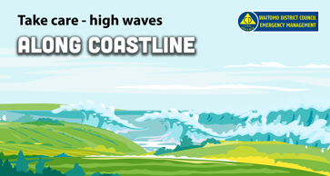
Take care – high wave warning along coastline
A high wave warning is in place for our coastline this weekend.
A strong westerly swell is expected from Saturday 24 January through to Sunday 25 January, with a swell event (high energy waves) and elevated water levels predicted.
This wave event is big, even for the west coast, with forecast swell over 5 metres and maximum wave height over 10 metres possible.
The highest risk period is within 1-2 hours of high tide.
The next high tide for the coastline from Marokopa to Mōkau is around 2pm on Saturday. For Sunday, high tide is around 2.50pm.
The potential for coastal erosion and inundation will present over high tide periods. Inundation levels with harbour areas close to the entrances may be close to king tide levels, but may include ‘surges’ that could raise water levels for short periods.
The wave event may exacerbate areas already prone to coastal erosion, such as Mōkau. Other areas along the west coast may also see erosion and inundation impacts.
Are you heading away for the long weekend? Or thinking about heading to the beach or going fishing?
We encourage you to stay away from the beach and coastline this weekend.
Coastal Inundation
With the high-wave warning, there is added risk of coastal inundation, which means flooding of low-lying areas along the coast.
Impacts include:
Damaged homes, businesses, and coastal infrastructure
Threatens coastal communities and ecosystems
Increases erosion as waves reach further inland
Take some time now to get prepared ahead of any potential impacts.
Key preparedness tips:
Secure outdoor furniture, trampolines and loose items if possible
Elevate appliances and valuable items
Never walk, drive or play in flood water. Flood water can contain dangerous debris, and can also make you sick.
Make a plan, think about where you would go if you needed to leave home quickly and how you will get there.
If you feel unsafe, evacuate to higher ground or away from coastal areas. You do not need to wait for an evacuation order to move to safety.
Help others if it is safe to do so, especially people who may require special assistance.
Helpful channels to stay up to date:
MetService warnings: https://www.metservice.com/warnings/home
WRC sea and river level data: https://www.waikatoregion.govt.nz/environment/envirohub/environmental-maps-and-data/?dt=Level
WRC coastal inundation tool: https://www.waikatoregion.govt.nz/services/regional-hazards-and-emergency-management/coastal-inundation-tool/
NZTA road conditions: https://www.journeys.nzta.govt.nz/highway-conditions
Council online service request form: https://www.waitomo.govt.nz/our-services/onlineservices/general-feedback/
Our Civil Defence team is actively monitoring the situation. We’ll share updates if anything changes.
Take extra care particularly when driving.
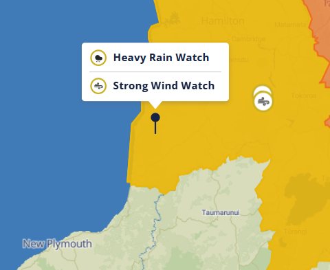
A large weather system associated with Tropical Low 14U is expected to move across parts of the country later this week.
Clear leaves and debris from gutters and drains to help reduce surface flooding Secure outdoor furniture, trampolines and loose items, strong winds can easily pick these up If heavy rain does arrive, never walk, drive or play in flood water. Flood water can contain dangerous debris, missing manhole covers and the contained water can also make you sick.
 Make a plan, think about power outages and where you would go if you needed to leave home quickly
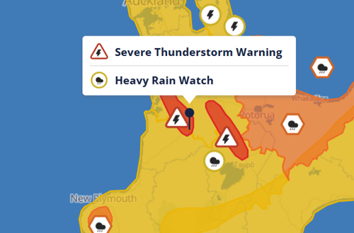
It's a yellow day today. Metservice has issued a yellow heavy rain watch for our district, which is valid until 11pm this evening (Thursday 15 January).
Stay safe and drive to the conditions
--
)
-
 Metservice weather warnings
-
Local road network updates
-
Report an issue
-
Waitomo District Council Facebook
-
NZTA road conditions
-
Power outages
-
Waikato Civil Defence
-
Here to Help U
-
Waikato Region Flood Room
-
Environmental maps and data
-
WRC coastal inundation tool
-
Civil Defence Hazards
-
Planning for an emergency
-
Civil Defence Archive
)
Support is available
If need support, you can free text or call 1737 to speak to a counsellor, or call Healthline on 0800 611 116.
Ministry of Social Development (MSD)
Financial assistance, welfare support, accommodation help. Call 0800 559 009 or visit your local MSD office.
MSD community services information
Rural Support Trust
Confidential support for farmers and the rural community. Call 0800 787 254.
Link to website
Here to Help U
Get free social and wellbeing support the easy way. Submit a quick online request and we'll get you the right support.
Link to website
Call 0800 568 273 and leave a call back request
NZ Red Cross
Red Cross helps vulnerable people all around New Zealand — supporting them in times of disaster or emergency, delivering hot meals and other community services.
Visit the Red Cross website
NZ Police non-emergency online help
Use the online report option to make a non-emergency report, or you can call 105
Online 105 form
How you can help
Check on whānau, neighbours, and anyone who might need help